
Overview
We develop air traffic control simulations for training dispatchers and combat controllers for air traffic management. At the same time this simulator allows to teach aircrews to interact with ground dispatchers and air control officers using voice protocols.
Core simulator features:
-
Real-time air traffic modelling and management
-
HLA based network simulator with lots of workplaces of dispatchers or air control officers who share the same virtual environment
-
Man-in-the-loop and computer-in-the-loop simulated aircrafts support
-
Modelling of airport-related environment
-
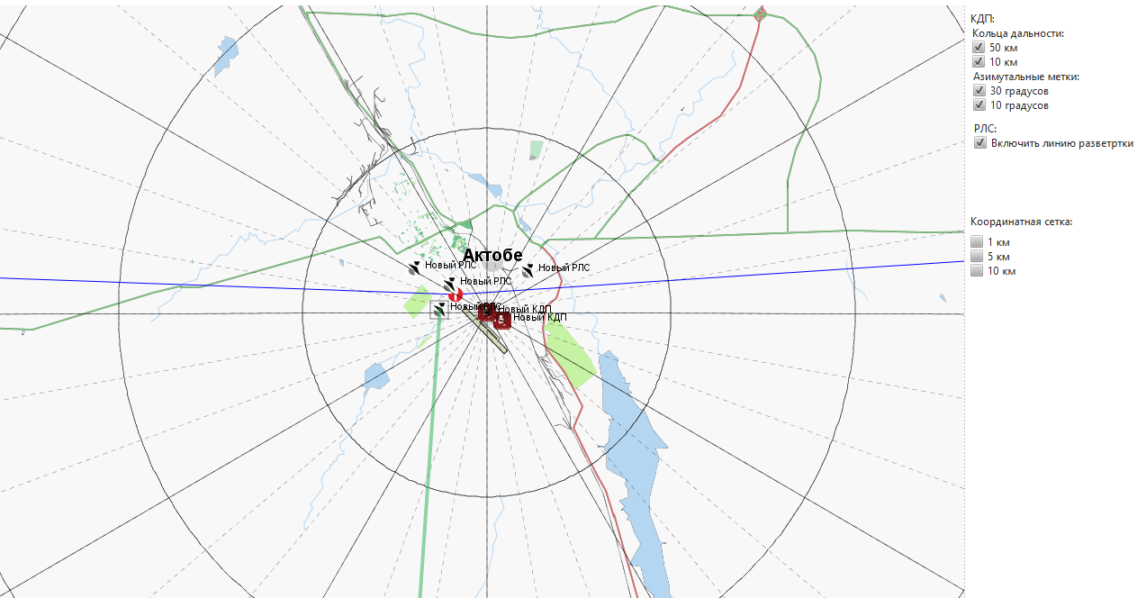
Radar work simulation with visibility zone calculation, azimuth grid and radar scan sweeps
-
Instructor Operating Station for controlling traffic, setting meteorological conditions, time of day etc, for aircrew answers voice accompanying for training dispatchers, accompanying computer-in-the-loop aircrafts behaviour according to a dispatcher’s orders
-
Editors for configuration of airport-related environment
-
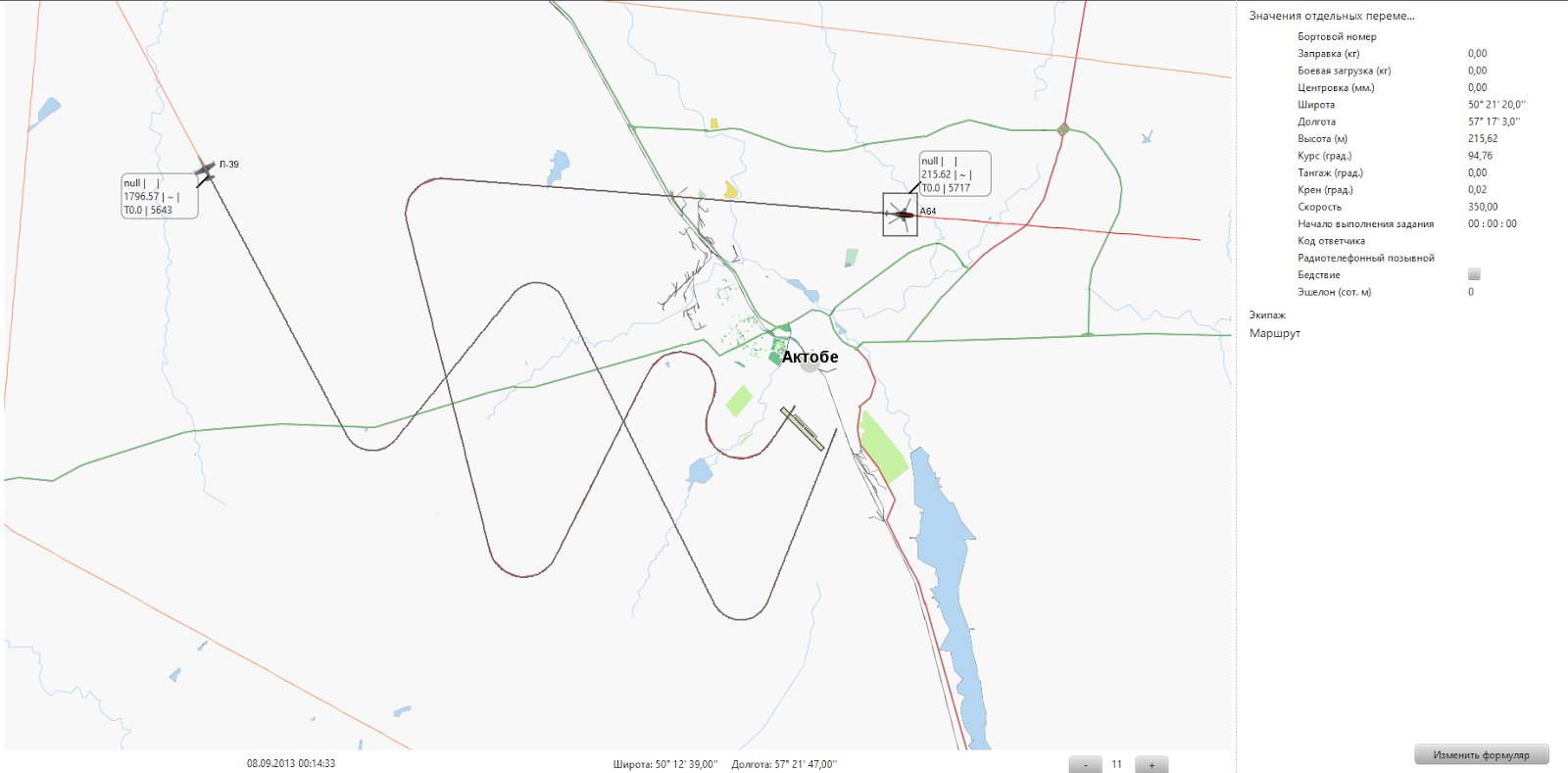
Realistic modelling of flight dynamics and trajectories, with correct turn radiuses calculations depending on aircraft properties
-
Distributed simulation recording for debriefing and after-action review
-
Geospatial-based, geodesy and cartography are widely used in calculations, e.g. distances, coordinates etc
-
On-map for a “big picture” and 3D views for situational awareness are available
There are network simulators with lots of workplaces for dispatchers or officers to work simultaneously with shared virtual world environment.
Using HLA protocol, aircrafts simulators deal with air traffic control simulator, so dispatchers can see on their screens both locations or man-in-the-loop and computer-in-the-loop simulated aircrafts.
Air traffic for air traffic control simulator can be prepared using mission editor. So dispatchers can be trained on a big amount of virtual aircrafts and preconfigured traffic.
To teach dispatchers and pilots to fly in some real country environment, real air traffic of this country is maximally modelled. For example, coordinate environment, navigational guidepoints, … Of course, real geographical maps are used in simulation.
Airport environment for this simulator is usually prepared using environment editor (see <environment editor> for more details). A great part of airport environment can be modelled in simulation: radar and radio stations, command and control centers, forward air control units, airfield runways, airborne early warning systems, airfield control towers, approach radar systems, radio beacons, FAFs, airfield traffic patterns etc.
Simulation of radar equipment is also modelled. Azimuth grid and radar scan sweeps are modelled and displayed on air traffic control workplaces. Visibility zone of a radar is calculated depending on the radar, aircraft type and terrain properties. Only aircrafts that are in the visibility zone can be seen by dispatchers.
Instructors use Instructor Operating Stations for more effective training of dispatchers and air control officers. Emulating of pilots’ communications and actions are modeled. For example, when a dispatcher starts voice communication with a computer-in-the-loop aircraft, a member of the instructor’s team answers him by voice protocol as if he were a pilot. He models pilot actions to dispatcher orders. For example, he can change the course, height or speed of his aircraft or give order to virtual AI to make landing, and we develop necessary IOS functionality to execute such actions.