
Digital vector map-based generation
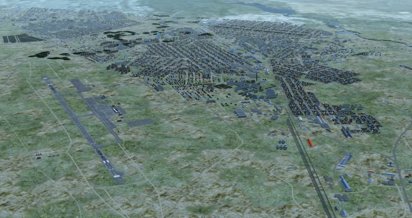
Here you can see restoration of one of real-world city using digital vector maps, terrain imagery, 3D models library and SRTM elevation map. You can see a roads, river in the top-right, city blocks and bush / tree areas that are generated automatically from correspondent vector map. Airport environment in bottom left was added manually
We have developed a framework that allows to create a virtual world area automatically using digital vector maps. With such a framework we can create simulation and 3D model of any real world area with minimal efforts.
In conjunction with relief modeling a framework can be generated automatically: relief, forests, land types, cities, villages, roads, rivers etc. Of course, for 3D visualization the corresponding models of trees, grass, buildings etc. should be defined as inputs of this module. If a customer does not have necessary 3D models, our 3D designers can create them according to the customer’s needs.
Of course, all necessary modifications to this simulator or 3D models can be brought in by an operator depending on the requirements.
Please, read section Vector maps based world generator for more information.